Sample Teaching Module on Participatory Mapping

Some time ago I had a great Skype call with Thomas Steele-Maley, one of the great forces in the deschooling movement. He was interested in some of my historical work on the uses of participatory mapping since 1920, and we started talking about what an out-of-the-box starter kit for kids (7th grade to 12th grade) (or for that matter undergraduates) might look like.
Meeting one:Discussion of landscape as an object of made history. Chapters on following "lines" (power lines, railways, roads) to understand the geometry of power from John Stilgoe, Outside Lies Magic.
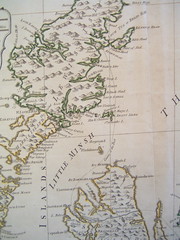
Meeting two:1-page handout on radical walking tour. The radical walking tour invites people of different generations and at least two different economic classes to participate in walking through a one of the city's older neighborhoods together, collaboratively building a story of what used to be there, who owns the land, who used to live there, who lives there now, and why. Participants should expect to tell the story based on particular buildings, using clues such as brick work, stone work, cemeteries, infrastructure, and property lines to talk about how the place was divided and by whom. In preparation for the radical walking tour, the teacher should acquire at least three different maps of the neighborhood from three different points in its history, teaching the students basic skills of map reading and providing some. Teacher should read Henry Randall, History in the Open Air (hard to find), or his article "History in the Open Air" (gated access), as well as perhaps the chapter I wrote, "Landscape," in Simon Gunn and Lucy Faire, eds., Research Methods for History (2011). Also consider the two-paragraph summary of the Boston group of Interested Critical Explorers of Publicly-Owned Private Spaces, "About Walking Tours."
Meeting three:
Students use walking papers and/or their cell phones to tinker with the technologies of changing a collective map. They might then upload their traces to Open Street Map, the shared, open-source version of Google Maps, which allows communities to annotate in enormous detail the parks and community gardens and other recreation spaces around them (check out Berlin for a really well-annotated city). The "hello" moment is typically one like the one I had a few years ago, where in an hour-long ramble with some librarian colleagues, I downloaded a new program onto my cell phone and used it to map three of the ornamental gardens at the University of Virginia campus. Two hours later I was gobsmacked to realize that putting a squiggle on a map, indeed a public and shared map, was as easy as writing a paragraph for a blog entry.

The red squiggles here were ornamental walkways actually walked by me, cellphone in hand. Here they are, and you can look them up and glimpse them for yourself by looking up the University of Virginia at Open Street Map.
Technologies such as these are a new form of writing, a new means of communication, and ease with them is one of the defining features of literacy of the digital age. It's experiences such as these that allow the teenager vaguely aware of urban policy issues to turn into a Bill Rankin, for instance, accomplished mapper of race in America's cities, among other things, who got his start as a boy scout sketching maps of the encampment for his fellow scouts to use. Map literacy is the tool of those who have it, and in their hands it becomes the means of entering conversations about privilege, access, and poverty in ways that put to shame more unwieldy forms of textual description.
Meeting four and after:
a collaborative project w Mapping Main st or million dollar blocks


0 Comments:
Post a Comment
<< Home