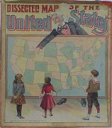
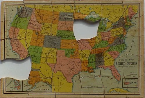
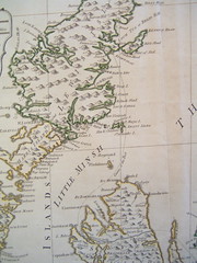
The Dissected Map
 Cheap printed maps also made possible a new identification with the nation. Britain’s physical shape of its borders became an icon for the first time, the subject of moral and political education in the classroom.
 Educational theorists like Maria Edgworth recommended the maps as a tool for teaching children to use hand and eye in conjunction. The first jigsaw puzzles, dissected maps consisted of an ordinary road-map, cut up into squares, left for the child to recompose on the basis of the whorls, coastlines, and words that fit together.
Such tools disappeared among generations who grew up with the shape of nations familiar as an icon; the cognitive challenge was smaller when the nation’s image was more commonplace. Only for children of a generation unfamiliar with the shape of the country, the dissected map was itself a challenge to put back together, the mind struggling to remember the indentures of coasts and the unfamiliar outline of the island viewed from above.
The maps reflected a burgeoning faith in the necessity of a nation's natural boundaries. William Paley explained, in 1828, the origin of the “natural boundaries” of Great Britain, arguing that any inner divisions of kingdoms within the island would have made the whole vulnerable “against the dangers that surround them;” arguing that a unified Britain was necessary, as any internal division into separate kingdoms would result in the conquest of the whole. William Priestley argued in his Lectures on History that each nation’s “natural situation” was of “great consequence either for defending ourselves, or of attacking others.” In exercises that patterned Paley’s sense of Britain’s perfect boundaries, Butler expected his students to name the southern and northern counties of England Scotland and their relationship to each of the island’s natural boundaries. Hannah More, similarly, had explicitly moral aims in mind when she applauded the turn towards geography in primary education. She exhorted that it would be “proper” always “to read history with a map, in order to keep up in the mind the indissoluble connexion between history and geography; and that a glance of the country may recall the exploits of the hero, or the virtues of the patriot who has immortalized it.”
More images? "I Collect Puzzles" has assembled a rather remarkable collection of nineteenth-century puzzle maps of the United States: http://www.icollectpuzzles.com/Maps/countries.htm
posted by Jo Guldi at 7:42 AM
![]()
![]()


0 Comments:
Post a Comment
<< Home