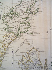
Landscape organizes everything within sight.

Tuesday, August 26, 2008

Power against the city: The infrastructure state in democratic nations

The way the story is typically told, eminent domain isn’t a problem for democratic nations like Britain and America; British and American towns are centers of a new, cosmopolitan, and intellectual commons. They invented the coffeehouse and the modern leafy suburbs, and their urban atmosphere was characterized by a contested but evolving civility, certainly not by the power of the state.

Some political ghosts are at work in this narrative. Wrapped up with the leftism of Cold War America, urban historians tend to associate the rise of modern urban planning with despotism, singling out the work of sixteenth-century popes like Sixtus V and nineteenth-century empires like Baron Haussman in Paris or Vienna and the Ringstrasse. Such a history tends to distinguish a despotic political system as the major threat to organic society.

We historians tend to exonerate British and American cities of similar activities. Isolated examples of control and demolition like the Bridewell reformatory, Regents Street, and the flaneur’s male gaze are therefore written off as partial examples of Enlightenment tendencies of control, outpaced in Britain by an expanding spirit of democracy; they are considered social problems, which in Britain never received political grounding, as distinguished from the systematic, despotic symptoms of control that characterized the contemporary cities of the continent. This account leaves Britain and America to stand as the major sanctuaries of freedom, democracy, and livable cities: coffeehouse paradises characterized more by the exchange of words than by visual symbols or spatial realities, more by bottom-up activities of writers and novelists than by the top-down efforts of planners and the state

Working at reforming such a narrative -- the article I'm currently working on -- means deploying some thinking of a kind that's nonintuitive, not just for British historians, but for historians of modernity in general.

My contention is that Britain invented, between 1790 and 1830, a new alliance between centralized state power, expert rule, and technology, endowed with the power to reconfigure human and natural environments on an unprecedented scale.

That political reality – the infrastructure state – had a social manifestation in the form of the modern age of landscape, an era where human environments were perpetually marked by their unprecedented scale, the lack of local political access to the mechanisms of design, and the visual symbols of state authority.

These elements came together for the first time in the edifice of the General Post Office, where Britain’s highways connected for the purpose of insuring the security and rapidity of the mails. The building was the result of the demolition of local neighborhoods, the usurpation of authority over design from the neighborhood, city, and event Post Office itself to the Treasury, and the creation of a nationally-revered visual statement about the nation’s identity, spread through lithographs and editorials across the four kingdoms. It inaugurated an era when the decisions of parliamentary experts rather than local builders came to characterize the substance of the everyday built environment, when the landscape itself became the direct conduit of state purposes and national identity.

Photo credit: Tracy Collins, documenting eminent domain at work in New York.

See also: Photos by Metroblossom, a very talented sociology graduate student at the University of Chicago.

Friday, August 22, 2008

The Dissected Map

Cheap printed maps also made possible a new identification with the nation. Britain’s physical shape of its borders became an icon for the first time, the subject of moral and political education in the classroom.

Educational theorists like Maria Edgworth recommended the maps as a tool for teaching children to use hand and eye in conjunction. The first jigsaw puzzles, dissected maps consisted of an ordinary road-map, cut up into squares, left for the child to recompose on the basis of the whorls, coastlines, and words that fit together.

Such tools disappeared among generations who grew up with the shape of nations familiar as an icon; the cognitive challenge was smaller when the nation’s image was more commonplace. Only for children of a generation unfamiliar with the shape of the country, the dissected map was itself a challenge to put back together, the mind struggling to remember the indentures of coasts and the unfamiliar outline of the island viewed from above.

The maps reflected a burgeoning faith in the necessity of a nation's natural boundaries. William Paley explained, in 1828, the origin of the “natural boundaries” of Great Britain, arguing that any inner divisions of kingdoms within the island would have made the whole vulnerable “against the dangers that surround them;” arguing that a unified Britain was necessary, as any internal division into separate kingdoms would result in the conquest of the whole. William Priestley argued in his Lectures on History that each nation’s “natural situation” was of “great consequence either for defending ourselves, or of attacking others.” In exercises that patterned Paley’s sense of Britain’s perfect boundaries, Butler expected his students to name the southern and northern counties of England Scotland and their relationship to each of the island’s natural boundaries. Hannah More, similarly, had explicitly moral aims in mind when she applauded the turn towards geography in primary education. She exhorted that it would be “proper” always “to read history with a map, in order to keep up in the mind the indissoluble connexion between history and geography; and that a glance of the country may recall the exploits of the hero, or the virtues of the patriot who has immortalized it.”


More images? "I Collect Puzzles" has assembled a rather remarkable collection of nineteenth-century puzzle maps of the United States: http://www.icollectpuzzles.com/Maps/countries.htm

Wednesday, August 20, 2008

The Parallax View


If today was not an endless highway
If tonight was not a crooked trail
If tomorrow wasn’t such a long time
Then lonesome would mean nothing to you at all


Tomorrow’s such a long time is Dylan at his very best: romantic, downcast, too tough to let you tell him that he’s wrong for feeling things, a little suspicious of the conditions under which he’s prone to let himself feel attachment. Dylan in that mood makes me want to hit the road, pull down the highway, and get out a map only after I’m three hours out of the city, cell phone off, dead to the world for weeks.

Dylan sings well about distance: distance was sort of his thing. The Jewish boy from Duluth, masquerading as a Santa Fe cowboy, playing a half-Mexican or half-Irish or Welsh poet in New York was reenacting one of Europe’s deepest myths, the one about the lovesick tramp or traveler. Like Walter Benjamin, Dylan had special access to that myth, by race and by personal experience, one of those chosen to travel. Travel fixed the bounds of his experience: it cemented the quirk of suspicion like a kniving splinter deeep in every love-song. Dylan didn’t sing about places, not places abandoned, left behind, returned to, remembered, cultivated, adored; unlike virtually every other folk-singer of the generation, each of whom left a litany of songs to particular places. I’m thinking about Neil Diamond’s honey-dripping hymns to Rocky Mountain High, or Simon and Garfunkel singing to Frank Lloyd Wright. Those are love-songs to places, real places; they’re spangled with their generation’s hopes of hoisting real utopias on earth, and they’re fashioned by the vatic singing of artists who think they’ve found something.

Dylan never allowed himself that feeling. Think about Kingsport Town or the Mediterranean earthquake that swallowed up an entire port of ambassadors, casinos, soldiers, and troublesome women. Dylan only sang to imaginary places and places he’d never been: or rather, he only sang about one place, an abstract place, the port-town where sailors hung out for a few heartsick and doomed weeks before leaving again. That town was surely Valparaiso and Singapore and Marseilles and Buenos Aires and Bangkok rolled into one: all the dirty haunts of gamblers and lovesick self-made ruins, where men who might otherwise be artists drank themselves into graves. Their lives offered a mirror to Dylan’s own, a worst-case scenario of what might happen to a love-sick artist if followed those strange cravings for the company of strangers, not into song but into travel instead. The broken, gun-slinging, hard-drinking traveler, he sensed, was an artist doing everything other than art.

I always liked Black Diamond Bay the best of these, the Mediterranean version of the same cautionary tale about a traveler getting into trouble, but this time – and perhaps it’s unique for Dylan – the traveler is a girl: “Out on the white veranda … Her passport shows a face from another time and place / She looks nothing like that / All of the fragments of her recent past are scattered on the wild wind.” The woman here is an exhausted and unimpressed woman in men’s clothes, capable of getting herself into a lot of trouble. She’s the girl from the Fitzgerald novel, the one half the men at the hotel are trying to make love to, but who’s been abandoned by the only men who can actually help her, because they themselves are suicidal. As in all the other songs, the character is unmistakably Dylan himself: stuck between the lovers of so many albums who said they loved him but knew they might be wrong. Dylan could still imagine a girl traveler in the same tragic and lonely place, and when he did, his inability to imagine her unlonely was so profound as to blow wide open his existential indifference to his own condition. The traveler’s vulnerability becomes the grounds for articulating the most sentimental carpe diem the twentieth century could deal with: because all travelers are united by the kinship of barely making it, their shared tales of loneliness might be worth singing about after all.

Tuesday, August 19, 2008

Maps and Nationalism

We like to think that modernity means the spread of information. Newspapers, maps, travel: all these things supposedly bind peoples into a single national whole. We like to think these things are true; but sometimes such stories are too easy.

In 1775, Boswell had just heard that parts of the East Indies were better mapped than the Scottish Highlands of Britain itself, and he found the fact outrageous. Johnson merely observed, “That a country must be mapped, it must be traveled over.”

Boswell, a Scot, thought he better knew what his English friend was thinking. Don’t you meant to say, he jibed, that "it is not worth mapping?”

In 1784, the modern view of the nation, with its boundaries firmly delineated, the shape of the country itself an icon, was transmuted from the heavy volumes of private libraries consulted by the gentry, into a medium more common, widespread, and accessible. These maps, one assumes, should have brought to an end anxieties like Boswell’s (in 1775) over the position of any particular people, assimilating them all into a single icon of national unity. Sixty years before the arrival of a national press, the visible shape of the nation, in tangible and portable form, offered Britons a ticket for exploration and a tool for identity.

Yet the cheap printed map was also the child of twisted corridors of state dissemination. Republishing the results of military conquest and survey, the cheap printed map indirectly translated the state’s activities for a consuming public. That translation was idiomatic at best.

For reasons that hinged upon the history of military mapping and the government’s lead role in distributing geographic data upon which commercial maps depended, the nation depicted in these maps was informed by peculiar distortions. The survey of Scotland performed in the 1750s that became the basis for early nineteenth-century maps was trigonometrically out-of-date; as new surveys of Scotland were delayed by a military more concerned with troubles in Ireland, the outdated data was rejected by cartographers.

Publishers instead routinely depicted Scotland as a white corner on the map, lopped off by the edge of parchment that fell just above Edinburgh. The standard nineteenth-century map of Britain that hung in classrooms excluded most of Scotland from the nation pragmatically defined. Such facts raise the question of what nation, exactly, modern Britons thought they belonged to.


C. Smith, Smith’s Map of England & Wales (London: Printed for C. Smith, 1830). (view full image at the National Library of Australia)


The traditional story of how modern Britons came to understand themselves as members of a nation tells a far more straightforward account of what national implied. Since T. B. Macaulay’s History of England of 1848, official accounts of British identity have tended to emphasize the eighteenth and nineteenth centuries as periods of successful assimilation, in which the fissures of earlier religious and political divides were healed by the salve of commerce, communications, and military exercise. While some scholars interrogate the limits of assimilation, even then, the received narrative tends to take for granted the inclusive work of enlightenment processes like communications and mapping. In fact, mapping itself was a creature of government, like the government-directed military and postal communications that spawned the early surveys upon which commercial cartographers depended. As a result, public maps took on contingencies of intension and empire that worked to structurally exclude Scotland from full integration in the consciousness of ordinary Britons. London publishers complained and Edinburgh cartographers tried to remedy the situation, but neither succeeded. It was the confusion of government practice, rather than English prejudice or Scottish self-assertion, that erased Scotland from the national map.

The map could only direct the traveler as well as allowed by the militarized history of cartographic practice. The common travelers’ aim, unlike the state, was not to police, but rather to plan a route through known and unknown regions, determining the likelihood of trade and the relationship between territories for secure travel and territories of adventure. As students, geologists, and railroads adapted standard maps to their own purposes, the fissures of the nation enshrined in maps were carried over to other practice. The tangible shape of the nation had become a tool of national distortion.

Labels: , , , , , , , ,

Saturday, August 16, 2008

The Nation's Fragile Skeleton


Early this summer most of America saw images of houses washing down the swollen Mississippi, logjammed against a bridge. In the following weeks we heard about the humans, libraries and even pets left homeless, but outside Iowa, few people heard about the problem of those houses, or indeed about that bridge itself. Iowans alone were left to contemplate their opportunities: When insurance failed, would FEMA provide? Would charity? Such questions only rise in importance the moment a reader in San Francisco or New Orleans or Miami pauses to consider who would repair their own city after disaster. For those who pay attention, the problem is wider still. Relics of the early 20th century, America's ancient dams and highways are crumbling with a shocking rapidity. The nation's skeleton is as fragile as the candy-cane bones sucked down to threads on Cinco de Mayo. Who replaces highways and bridges once they're gone?

Most Americans alive today grew up in an era when state infrastructure was on the rise. Some can remember still the monumental Mississippi flood of 1927, which propelled the nation into an unprecedented glut of levee-building. In 1944, the Pick-Sloan Plan gave the Army Corps of Engineers control over 316 reservoirs, dams, navigation projects and flood control zones across the nation. Seventy-year-olds still remember glowing documentaries boasting the efforts' star initiatives: the Tennessee Valley Authority and Rural Electrification. In the 1950s and '60s, state engineers spread pylons and arches and overpasses across the nation. They connected and canalized; they filled the landscape with the rumbling sound of commerce on highways, rivers, ports and streets.

That phase of building was associated with a 200-year trend in politics, in which infrastructure became the favorite experiment of expanding nations. The infrastructure state, however, is no more a reality; it has been dramatically eroded by the postwar politics of suspicion.

Read the rest of my article on Alternet.